
Sources for Roane County Adjacent Parcels
No Roane tool picks out every parcel beside an address automatically. That job falls to you. The block method works well: open a map viewer, find the subject, jot down the parcel IDs nearby, then run each ID through the assessment search. The County Clerk's plat category can help. It can test whether map-adjacent parcels share a recorded lot or boundary line.
| Source | What It Shows About a Block | Access |
|---|---|---|
| WV Property Viewer | Surface polygons and selected parcel details | Use map selection and labels; no adjacent tool confirmed |
| Roane Assessor ArcGIS map | County parcel geometry and local map view | Dynamic app; inspect directly and verify each ID |
| WV Assessment Search | Owner string and assessment fields for each ID | Search one neighbor parcel at a time |
| County Clerk plat maps | Recorded lot, road, and easement relationships | Ask for a plat using parcel and deed references |
Start with the West Virginia parcel viewer. Keep the block search anchored to the subject ID rather than to names alone. The tax roll names an assessment owner. That owner is not always the person living on the land. Map card ownership can lag the newest deed too. The viewer's Copy Link and Download KMZ controls are handy for saving a map reference. Neither one certifies title or adjacency.
The selected parcel card supplies the identifiers you need for a follow-up assessment search, while the map itself stays a visual reference.
Map Roane County Neighbors by Parcel ID
The neighbor workflow starts with one known parcel. Select the subject polygon and record the full ID and GIS ID. Then pan along its borders and read the IDs printed on the polygons around it. The statewide viewer offers Highlight and Details controls. Its interface exposes no select-by-location, buffer, or automatic adjacent-parcel tool. The Roane ArcGIS app is dynamic. Open it in a live browser before assuming a specific control exists there.
- Find the subject address or parcel in the Roane or statewide map viewer.
- Record its parcel ID, community, E-911 address, and legal description.
- Identify touching or nearby polygons by map labels, then copy each parcel ID.
- Search each ID in the assessment portal and compare the owner string and description.
- Use a recorded plat or survey to confirm whether a parcel truly abuts the subject.
- Adjacent
- Near or beside another parcel on a map; the term alone does not prove a shared legal line.
- Abutting
- Sharing a boundary as shown by a legal description or survey.
- GIS ID
- A map key that may omit one element of the full parcel ID.
- Buffer
- A distance-based map selection; no named Roane buffer tool was confirmed.
Roane County Street Search for a Block
The assessment search includes a Street Name field. It works well as a backup when map labels are hard to read. It also helps when a rural road has several nearby parcel cards. Search by street name. Then compare district, map, parcel, owner, E-911 address, and legal description across results. Exact and partial matching behavior is not documented. If the first query returns nothing, retry the road name without a house number.
A street search can return parcels along the same road that share no boundary. Keep the block list labeled as road-associated until the map or plat confirms true adjacency. A mailing address can point outside the subject's road or community. Do not use it to decide who lives next door.
The West Virginia assessment search shows the street and parcel fields used to identify each property on the block. The form is displayed on its official page.
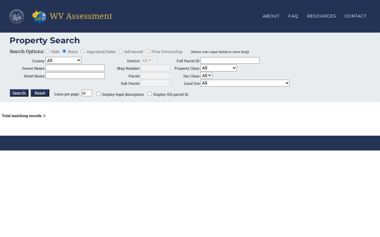
Search each neighbor separately and keep the map ID beside the owner name the tax roll returns.
Roane Parcel IDs Around a Property
West Virginia parcel numbers come in several shapes. You may see a full six-part ID, a GIS number, a CAMA/IAS version, or an abbreviated form. The full root combines county code, district, map, parcel prefix, parcel suffix, and special ID. The GIS form drops the special ID. CAMA/IAS leaves off the county code. Copy each neighbor's parcel number exactly as it appears. A shortened number may fail the full assessment search field. For the subject property and each nearby parcel, record the full ID, owner of record string, E-911 or physical address, community, legal description, and map location. When an identifier seems to differ between the assessment and the map, compare the underlying description before calling it a new lot or an owner change.
Roane Plats and Shared Boundaries
The Roane County Clerk's land-record page posts plat maps. It offers no subdivision list, HOA layer, or plat book-and-page inventory. Ask for the plat that matches your deed or lot reference. Then compare adjoining lot numbers, roads, easements, and the legal descriptions on both parcels. A plat proves a planned lot relationship. It cannot settle current boundaries on its own. For assessment, deeded acreage outranks GIS-calculated acreage. State guidance treats tax-map lines as inconclusive evidence in court. A legal boundary dispute calls for a survey. Until then, treat neighboring lots as map-adjacent rather than confirmed abutting parcels.
Roane Road Names and Rural Neighbors
Spencer sits where U.S. 33 meets U.S. 119. State Route 36 and State Route 14 serve other parts of Roane County. Reedy developed near the Ravenswood-Reedy Turnpike and the Reedy-Spencer Road. Older deed records may name a road, creek, district, or community instead of a modern house number. Those place clues help orient a neighbor search. The parcel ID and deed must carry the match. A Spencer postal address can lie outside the corporate boundary. A rural parcel near Reedy may carry a community or route label. The same postal route does not make neighbors. Map the parcel first, and lean on municipal boundaries only when the local jurisdiction itself matters.
Roane Map-Adjacent Results Need Review
Tax maps are handy, but they have limits. The state parcel and assessment FAQ states plainly that tax maps serve as reference tools. They are not legal evidence of a boundary. It also notes that acreage figures are calculated values. Parcel lines can lag behind a recent split. A map may not reflect the newest division of land. The FAQ walks through parcel identifiers, update timing, and acreage in more detail. It also covers the map disclaimer. For a Roane County parcel question, treat the map as a starting point.
A shared line deserves more care when money or access rides on it. A proposed driveway, easement, fence, sale, or land-use decision may depend on where a Roane County boundary sits. Compare both deeds and any recorded plat first. Then bring in a licensed surveyor to locate the line on the ground. Never call a strip of land a neighbor's property. Do not base that call on how it appears at the edge of a screen.
Mark any unconfirmed relationship as map-adjacent until the legal description or survey supports it.
Map the Roane County Property Block
A block-level lookup should keep every land record traceable. Start with the subject parcel. List the nearby parcel numbers next. Use the assessment owner field for each one, and keep the source and date of every map view, because the statewide surface file is refreshed annually and the county app may show a different interactive layer set.
- Locate the subject on the WV Property Viewer or Roane Assessor ArcGIS map.
- Read nearby surface parcel labels manually; no buffer control was confirmed.
- Search each parcel ID in the assessor roll and note the Property Owner field.
- Check each deed or plat when a boundary, easement, or ownership issue turns on the result.
- Subject parcel
- The specific parcel used as the starting point for the nearby-lot search.
- Neighbor parcel
- A nearby map polygon whose legal relationship still needs checking.
- Plat
- A recorded lot map that can help compare roads and parcel relationships.
Annual Updates and Roane Parcel Splits
The state surface parcel file is assembled each year from county GIS data and assessment attributes. Timing explains most surprises. A fresh split may lag its recorded deed. A simple sale can still show the old owner of record until the next assessment refresh. The state FAQ sets a firm schedule. Tax-map changes for transfers from July through June are due by the following February 1. It also suggests calling the assessor when a line stays wrong two years after a transfer.
A missing neighboring lot usually has a simpler explanation. Compare the newest deed, the recorded plat, and the current map before blaming the geometry. Ask the Roane Assessor whether it was submitted. No adjacent tool can be trusted when its underlying parcel layer has not been updated.
Limits on a Roane County Neighbor Lookup
The assessor and parcel viewer show public record fields, not a list of occupants. They name no residents. West Virginia's property viewer FAQ treats ownership and map information drawn from deeds and property records as generally public, though phone numbers and alarm-system details are redacted before release. Keep the focus on parcels, boundaries, and access. A neighbor lookup supports property diligence, not watching people.
Lawful use. Roane County neighbor research is for lawful property and civic questions. Do not use parcel-owner data to watch, threaten, harass, or harm any person. Confirm legal boundaries with the deed, plat, or survey.