
Start a Roane County Property Search
Start with what you already know. A current street name is often the easiest key. An owner name can pull up every parcel held under that name. Trusts, estates, and companies may file under a different string. When another record has supplied a full parcel ID, use it. It is the cleanest exact route. The West Virginia Property Assessment Search takes these values in separate fields. It also adds filters for district, class, tax class, and land use.
Once a result appears, copy down the parcel identifier. Note the owner field, the physical address, and the legal description as well. The parcel ID carries the result into the state map or the Roane viewer. The owner and legal description carry it into the County Clerk's recorded index. One matching street line is not a final identity check. Compare the district and map references too, especially along rural roads where similar addresses repeat.
- Enter Roane County and the best known street, owner, or parcel value in the WV Property Assessment Search.
- Compare the result’s owner string, physical address, community, E-911 address, and district-map-parcel information.
- Turn on the legal-description and GIS-ID display options when they help link the card to a deed or map.
- Use the WV Property Viewer or Roane ArcGIS app for location context, then search the County Clerk’s land-record categories for recorded proof.
- Ask the custodian about older books, images, and copy costs because Roane’s online coverage and fees are not stated on the inspected landing page.
Fields in the Roane County Assessment Search
The statewide form splits its filters into owner, street, map, parcel, and class, and it also exposes controls for the legal description and the GIS parcel ID. The portal publishes no documented match rules. Partial name and street behavior, the select menus, and the search buttons are not explained on the form itself. Start with one known key and test variants rather than assuming a particular match rule.
| Portal field | Type | Use and notes |
|---|---|---|
| County | Select | Choose Roane County; options are statewide and dynamic. |
| District | Select | Local district options were not exposed in the text capture. |
| Full Parcel ID | Text | Enter the full hyphenated identifier when known. |
| Owner Name | Text | Try person, company, trust, estate, and spelling forms. |
| Map Number / Parcel | Text | Use the component shown on a tax map or card. |
| Property Class / Tax Class | Select | Exact dropdown options were not captured. |
| Street Name | Text | Closest verified way to look along a road. |
| Sub-Parcel | Text | Use only when the source record shows one. |
| Land Use | Select | Exact dropdown options were not captured. |
| Legal description / GIS ID | Display controls | Enable these to carry the result into deeds and maps. |
| Search Options | Modes | Basic, Appraisal/Sales, Advanced, and Prior Ownership are listed. |
The state search form shown here is the public page that supports a Roane County lookup, displaying its fields rather than the contents of any one parcel result.
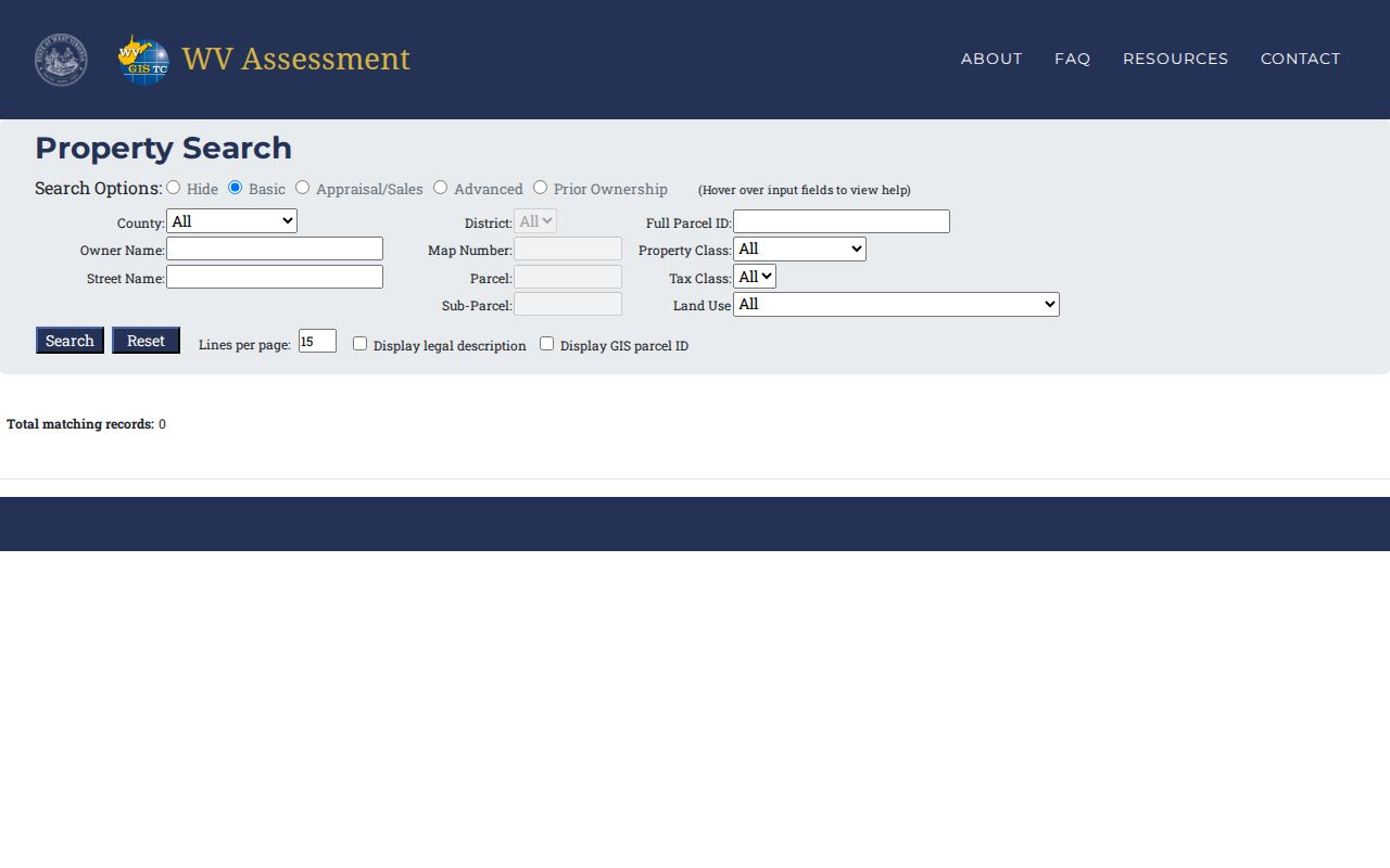
Pay attention to the search mode you select, since appraisal, sales, and prior-ownership results can differ from the basic parcel card.
What a Roane County Parcel Result Shows
The assessment result is a working record card, not a full title file. The state parcel viewer labels its fields as Property Owner, Physical Address, Description, Building Information, Cost Values, and Appraised Values. These fields cover the basics. It also displays community, E-911 address, delinquent status, and flood information. These labels help you identify and compare a parcel. The Roane card does not promise every field a real-estate review might want. Some items, like a last-sale date, may simply be absent.
| Property Owner | Owner string in the assessment data; confirm a recent transfer by deed. |
|---|---|
| Physical address and E-911 | Location labels that can differ from a mailing address or legal description. |
| Community | Local place name shown separately from the address. |
| Parcel and GIS ID | Identifiers that connect the assessment record with map geometry. |
| Description | Legal-description field available through the display control. |
| Building, cost, and appraised values | Assessment details; last sale and mailing fields need live confirmation. |
The viewer's general card inventory appears on the official WV Property Viewer. Roane County parcels load dynamically there. Open a selected parcel card directly to see its full contents.
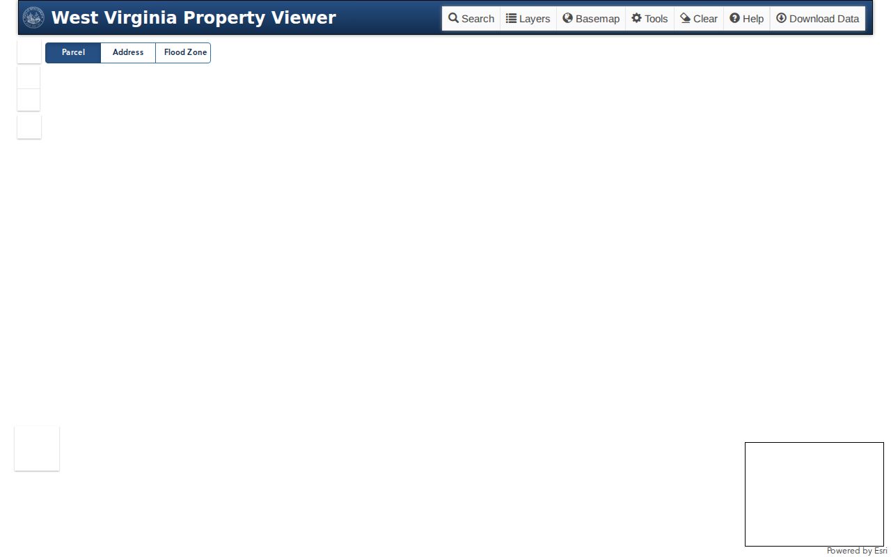
Use these fields to carry the parcel into another source. The displayed owner is the assessment-roll owner of record, not a guarantee of present title.
An assessment card cannot prove clear ownership, list every lien, or settle a legal boundary. The County Clerk's deed index answers one set of questions. Court files, tax collections, and a survey each answer different ones. A last-sale date or mailing address may not appear on the Roane card. Verify those fields directly. Do not fill gaps from a neighboring parcel or an outside directory.
Reading Roane County Address Labels
West Virginia's parcel tools separate physical address, E-911 address, community, and parcel identity. Each label serves a different job. E-911 data exists for emergency response. A community name reflects local geography. A mailing label shows where correspondence goes. The deed's legal description records the land actually conveyed.
A rural Roane property can carry a route number, a community name, a modern E-911 address, and an older road or creek description all at once. If the street search returns several cards, compare owner, district, map, parcel, and legal description instead of grabbing the first house-number match. When a street search fails, drop the number, try the road name, then test owner or parcel search. Note each address form so it can be checked against the deed.
Roane County Parcel IDs Across Portals
West Virginia builds its root parcel identifier from six parts. These parts are county code, district, map, parcel prefix, parcel suffix, and special ID. The state GIS ID omits the special ID. CAMA and IAS displays can omit the county code, and shorter district-map-parcel forms also circulate. Roane's statewide county code is 54. Even so, copy the portal's displayed identifier exactly rather than reconstructing it from memory.
For a cross-check, keep both the full ID and the GIS ID. Do this whenever the result shows both. The assessor search offers fields for Full Parcel ID, Map Number, Parcel, and Sub-Parcel. A plat or deed may rely on a lot name or legal description instead. The number is a bridge among systems, not a replacement for the underlying text.
When a Roane County Search Is Stale
West Virginia refreshes the property viewer once a year. New assessment data drive that update. Ownership, use, and value are set each July 1 for the coming tax year. A plain sale of an unchanged parcel may not reach the state roll right away. Tax-map changes covering transfers from July 1 through June 30 are due to the state by February 1 of the following year. A new parcel split can lag even longer than a sale with no boundary change.
A recorded deed may look newer than the assessment card. Compare the recording date and the parcel description before assuming the owner field is wrong. A just-recorded deed or a correction belongs with the Roane Assessor. For a recently completed conveyance, the clerk's newest recorded instrument is the stronger record. The county assessor stays the current source for assessment. State guidance on parcel IDs, annual refresh, acreage, and map limits explains the lag. The two systems can disagree for a time.
Old Spencer Names in Roane Searches
Place names shift, and searches suffer for it. Spencer was founded in 1858. Local history records earlier names such as Tanner's Cross Roads, Cassville, and New California. A modern address search can therefore miss an older deed or notice. Records may instead name a creek. They may name a road, a district, a lot, or a vanished community. Start with the current owner and parcel. Then work backward through the recorded grantor and legal description to trace the older chain.
Roane's county-seat role concentrates the courthouse and county offices in Spencer. City Hall is still a separate municipal contact. Deed questions belong with the County Clerk. Planning, street, water, or unsafe-structure files belong with the municipal office that handled the work. Treat the place-name clue as a way to interpret records. It is not a substitute for a parcel match.
Roane Owner Names for Estates and LLCs
The legal holder of a parcel may be an estate, a trust, a company, or a successor. An owner-name search can miss the parcel in those cases. Try the assessor's exact displayed name first. Then try shortened versions, initials, and the grantor or grantee name from the deed. The state assessment portal does not say whether matching is exact or partial. Spelling itself becomes a search variable.
When an LLC or corporation shows up as grantee, the Secretary of State's organization search can return public filing, agent, and officer details. Its advanced search covers street, city, county, state, organization type, and record ID. CSV search is paid, though. An organization filing does not list every private beneficiary. It also does not prove the entity still owns the land. For that answer, return to the County Clerk instrument and the parcel's assessment card. The standard West Virginia business search is a cross-reference, not a property database.
Roane County Search Fallbacks
The land-record landing page lists deed categories. It does not show the online search fields, image options, or an earliest index year. A missing record may sit in another category, an older book, or microfilm. Ask the Clerk. The page publishes no fee schedule either. Confirm the current Roane copy, search, image, and certification charges before ordering anything.
For a public record held by a county or state body, West Virginia FOIA applies. It requires a request with reasonable specificity. Identify Roane County, the office, the names, and approximate dates. Add the record category, parcel ID, and book or page if known. Under W. Va. Code §29B-1-3, the response is due as soon as practicable. It is due no later than five days, excluding weekends and holidays. Reproduction fees may reflect actual cost. No search or retrieval fee may be charged as part of reproduction. The FOIA statute is the fallback when a portal does not expose the record. It is not a substitute for asking the custodian which record exists.
Choose a Roane County Search Key
Pick the search key that matches what you already hold. Address search suits one known place. Owner search can turn up several parcels. It depends on how an estate or business entity is named. Parcel search works best once a tax card, plat, or deed has supplied a parcel number. A parcel number makes the match exact. Before carrying any result forward, compare the legal description and district details the county returns.
| Search Key | Best For | Where It Works | Watch Out |
|---|---|---|---|
| Street name | Locate parcels along a known road | WV assessment search and GIS | Community, E-911, and deed labels may differ |
| Owner name | Find land listed under a person or entity | Assessor, then County Clerk | Try estate, trust, company, and spelling variants |
| Parcel ID | Match a known tax-map record | Assessor and state viewer | Full, GIS, and abbreviated forms can differ |
Not a title search. A Roane County property search is a way to locate records. It cannot establish clear title, reveal every unrecorded claim, or settle a line on the ground. Read the deed chain and consult a title professional or licensed surveyor when legal rights depend on the result.