
How to Search Reedy Property Records
A Reedy parcel follows the same county trail as any other Roane County parcel. Open the state assessment search and choose Roane County. Then search by owner name, street, or parcel number. The result points you to a map and parcel identifier. Keep in mind it is an assessment record. It is not proof that an address sits inside town limits. Compare the county clerk's deed index and the state parcel viewer next. For broader help, the county site offers guides on property search and parcel maps. This page sticks to the quirks that make a Reedy search ambiguous.
- Search the West Virginia assessment portal for Roane County, then try the physical street name without relying only on a mailing label.
- Use the owner name or parcel identifier shown on the result to look for the matching conveyance in the county clerk’s land records.
- Review assessment class, value, and tax status separately; a tax balance is not a deed-history result.
- Open the state parcel viewer to compare the mapped tax parcel with neighboring tracts and road labels.
- For town-operated service, street, or project questions, contact Reedy directly; no public address-searchable town permit or zoning portal was located.
When an address search stalls, pull the parcel number from a deed, tax notice, or older map. Confirm each part of the number before opening a record. The same road segment in rural Roane County can carry several names, and the assessment system often holds the identifier even when the address is incomplete. The record path stays county-based throughout. Town contacts help with municipal services. Deeds, values, and tax maps stay with the county and state systems.
Where Reedy Property Records Are Kept
The Roane County Assessor keeps the assessment roll. It drives taxation, property class, and appraised values. The Roane County Clerk records deeds and related instruments. The state's parcel viewer displays tax-map geometry and selected property details. Reedy handles municipal concerns through its own town contacts. The town keeps no separate recorder, assessor, or searchable permit database. Knowing which office holds the record saves a wasted trip.
Roane County Records (deeds, values, parcels)
Use the state assessment search for the roll and county clerk for recorded instruments tied to Reedy parcels.
Reedy Municipal Contact
118 Main Street
Reedy, WV 25270
304-927-3222
Reedy Neighborhoods and Recorded Subdivisions
Reedy has no published list of named subdivisions, plat-book entries, or indexed neighborhoods. That gap matters. A resident may call a spot a neighborhood, while the deed relies on an older tract, lot, or metes-and-bounds description. Never assume a subdivision label from a mailing address. If a deed mentions a plat, take its recording reference to the county clerk and inspect the actual map. Then compare the geometry against the state parcel viewer. Invented subdivision names help no one. The recorded documents are the authority.
| Neighborhood / Subdivision | Era | In the Records |
|---|---|---|
| No verified named subdivision | Not established | Search using the deed description and county parcel identifier. |
| Road-side and crossroads tracts | Varies | Use street or route wording as a clue, not as a boundary. |
A sale document with a lot number or subdivision name is a strong lead. Search that exact wording in the recorded deed. Ask the clerk for the referenced plat. A parcel map orients you, but it cannot replace the recorded map or a survey. A missing subdivision name online does not mean the tract lacks a legal description. Often the parcel is simply indexed under a former owner. It may also appear under a road name or a parent tract.
Reedy’s Crossroads and Older Road Descriptions
Local history puts Reedy where the Ravenswood-Reedy Turnpike meets the Reedy-Spencer Road. Those route names are real clues in older deeds, maps, and family property references. They help most when a modern street address returns nothing. Roads get renamed, renumbered, or described by the destination they once served. Try alternate spellings and route wording when a search comes up empty. Then check the deed's adjoining owners. Check that its physical description actually fits the parcel in question.
A crossroads reference marks history, not a boundary. Treat it as neither a town limit nor a parcel line. For a chain of title, record the book and page from each deed. Also record the instrument reference. Compare grantor and grantee names in sequence. For a location question, set the legal description beside the tax map. Then set it beside the road centerline and the municipal information. Each source answers a different question. Each may also spell the place name its own way.
Reedy Mailing Addresses and Town Limits
The 25270 ZIP code is a delivery label, not a boundary map. A Reedy mailing address can attach to land well outside the incorporated town. Postal geography says nothing about municipal services, ordinances, or town records. An assessor entry showing a Reedy physical address does not settle the question either. For anything boundary-sensitive, start with the parcel's legal description and map. Then ask the town and county which boundary record governs.
Addresses also render roads and routes differently. Keep the wording from a tax notice or deed exactly as printed. Is the full address not indexed? Try a shorter street-name search in the assessment portal. Two parcels can share a similar mailing address. Use the map and parcel identifier to tell them apart. For ownership or jurisdiction decisions, trust the legal description and survey. Trust the municipal boundary source over the ZIP code too.
Reading a Reedy Parcel Identifier
A West Virginia parcel number is built from several parts. County, district, map, prefix, and suffix each carry meaning. Some identifiers add a special code. Different systems show different pieces. The state map viewer can drop the special-ID element. The CAMA assessment system can drop the county code. So the same Reedy parcel may look shorter on one screen than another. Copy the identifier exactly as the source record prints it. Compare the map and parcel portions before assuming two records disagree.
Rural descriptions add another wrinkle. A single tract is often divided over time. The current assessment roll then shows a new parcel. Older deeds point back to a parent tract or a predecessor number. When that happens in Reedy, record the identifier along with its date or tax year. Then bridge the historical references through the deed's legal description. If a map number is handwritten or smudged, confirm it with the assessor. Guessing at a digit can send a property search down the wrong path.
Reedy Town Requests and Property Work
Some questions belong with the town of Reedy rather than the county. Town services, roads, public improvements, and municipal decisions all sit in town hands. Reedy publishes no address-searchable permit, zoning, or code portal, so an online parcel lookup for construction history is not something to expect. Instead, ask the town directly whether it holds a given record. Describe the address, parcel, project type, and rough time period as precisely as you can.
The municipal-contacts directory lists a town phone, 304-927-3222, and names a recorder, Hollie Cherry; it lists no clerk. A title alone does not tell you which records that person keeps. Confirm the right custodian before filing a request. Deeds and conveyances go to the Roane County Clerk. Assessment and parcel classification questions start with the county assessor. Keep copies of any response, and note when a request is referred elsewhere.
The West Virginia municipal contacts directory lists Reedy’s town contact information.
Rural Reedy Parcels on the Map
Reedy sits at a crossroads surrounded by rural tracts. A good map shows how it all connects. Road labels, adjoining parcels, streams, and parent tracts become far easier to read spatially. Remember what a tax map is, though. Its lines are best-fit depictions, not legal boundaries. Deeded acreage in a recorded instrument controls, and a GIS polygon's calculated acreage does not. A split tract adds timing issues. The map and assessment record can lag behind the deed reference.
Start with the parcel viewer to get oriented. Note the tax map and parcel, and jot down the neighboring identifiers. Then compare the map against the deed and any recorded plat. Acreage, access, and boundary questions call for the recorded instrument plus a qualified surveyor. Flood overlays and similar layers can flag issues worth checking. But they establish no ownership rights and no official determination.
Reedy’s Small-Town Record Context
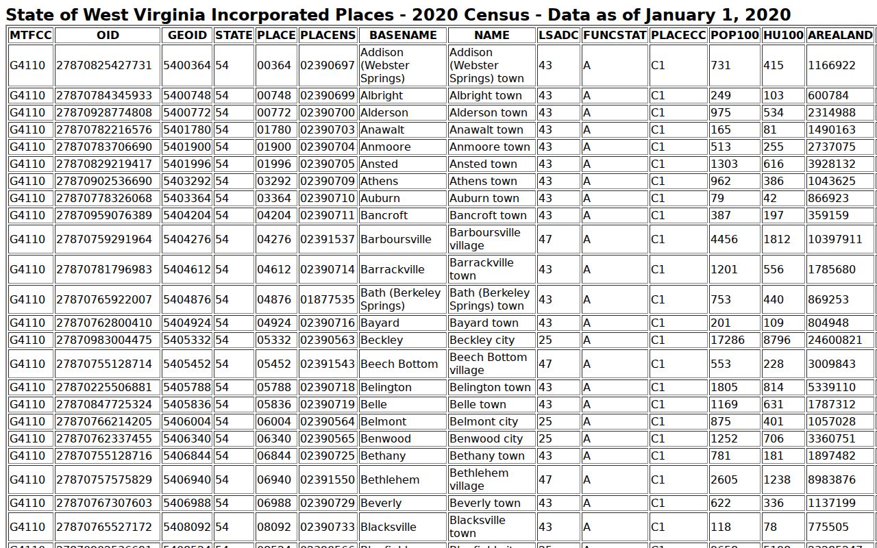
The 2020 Census counted 150 residents in Reedy. That figure describes the scale of the incorporated place and nothing more. It is not a property count, an assessment total, or a market trend. No Reedy-specific time series for sale prices or assessed values is published. Treat any value claim with care. Countywide or statewide value changes should never be applied to an individual Reedy parcel. Check the parcel's own appraisal record, property class, condition, and comparable sales first.
The Census Bureau’s incorporated-place table gives Reedy’s 2020 population context.
For a parcel-specific value question, pull the county assessment detail first. Check the July 1 valuation date, then compare recorded sales with care. Ask the assessor how a classification or valuation was reached. If a formal appeal makes sense, follow the published Board of Review process. A sparse local market makes comparable sales harder to interpret, which is one more reason to keep parcel facts separate from general demographic data.
Reedy Transfers and Tax-Map Updates
Roane County's assessment roll runs on an annual July 1 valuation date. Even a simple transfer can show up after the deed is recorded. A split or a revised tax map takes longer still. After a Reedy purchase, inheritance, or lot division, write down the instrument date and the full parcel ID. Then compare the deed against the current assessment card and parcel viewer. A mismatch often reflects update timing or identifier formatting. It does not mean the deed is missing or the map is wrong.
West Virginia parcel IDs can include county, district, map, prefix, suffix, and a special identifier. The parcel viewer and the assessment system may display different portions of the whole. Roane County's county number is 54. Even so, use the full value shown on the official record. Do not build an identifier from memory. When a new lot has not yet appeared in the map layer, ask the Assessor about the map-change schedule. Ask the Clerk for the recorded deed or plat reference. For any boundary determination, the recorded legal description and a survey remain essential.
What Reedy Property Records Show and Their Limits
A Reedy property search can tell you a fair amount. Property records here reveal the parcel number. They also show the assessment classification and the listed owner of record. You can trace recorded conveyances. You can check the tax status of a parcel. Its location appears on a plat or GIS map. Some results lead further into municipal files on town services or public projects. Keep timing in mind. Different property records follow different update schedules. A recent transfer may lag before it reaches the assessment roll and tax roll. Treat any result as a starting point. It is not proof that every field is current. Nor is it proof the parcel sits inside town limits.
Know the limits of what these documents can do. An assessment map does not establish surveyed boundaries. A tax value is not an appraisal of current market value. An owner-name result, likewise, is not a title opinion. When a legal ownership question arises, review the recorded chain of deeds in the deed records. For a boundary dispute, rely on the controlling legal description and a licensed surveyor. Before depending on any copy, confirm the recorder's current process and charges. Do not trust an unofficial screen capture.
Lawful use. Use public property records for ownership research, transaction due diligence, tax questions, and civic transparency. Do not use owner information to stalk, harass, or harm anyone.