
Search the Roane County Record Trail
Roane County property records live with several custodians. Start with the West Virginia Property Assessment Search. A street name, owner, or parcel identifier there can point you to an assessment card. The card identifies the parcel. It is not the deed. For a conveyance, deed of trust, release, lien, or plat, the Roane County Clerk's land-record index is the next stop. The state parcel viewer or Roane's ArcGIS map then shows the parcel's shape and map context.
Keep each question narrow as you move between systems. An address locates a parcel. The Clerk's recorded deed shows the parties and the legal description. The assessor roll shows the owner string and the value used for assessment. The Sheriff or State Auditor route covers tax status. A tax map is not a survey, and an assessor entry is not a title opinion. For a city permit or public-work question, contact the city that handled the work instead of assuming the county deed index holds that file.
- Search the state assessment portal by street name, owner, or parcel, and note the exact district and parcel format shown.
- Use the Roane County Clerk land-record categories to locate a deed or related instrument under the parties’ names.
- Compare the assessment year and owner field with the latest recorded deed if a transfer is recent.
- Open the parcel in a map viewer for context, then use a recorded plat or survey for a boundary question.
- Ask the custodian about older books, copies, and costs; use a specific West Virginia FOIA request when a public record is not exposed online.
Where Roane County Property Records Are Kept
The County Clerk of the County Commission records Roane County deeds and land instruments. The Assessor maintains the assessment roll and surface tax-map information. The Sheriff handles county tax tickets and collections. The State Auditor's County Collections portal opens delinquent-land research at the state level. No single database merges these roles. Follow each record to the office that created it.
Roane County Clerk
Roane County Courthouse, 200 Main Street
Spencer, WV 25276
304-927-2860
Roane County Assessor
Roane County Courthouse, 200 Main Street
Spencer, WV 25276
304-927-3020
Roane Sheriff and Collections
County tax tickets and payment questions
Roane County, West Virginia
Confirm current contact with the county
The West Virginia County Clerk directory lists Roane County’s courthouse contact details.

Roane County Clerk Index and Deed Records
The Roane County Clerk's land-record page lists deeds, deeds of trust, judgment liens, government liens, releases, assignments, agreements, affidavits, cemetery deeds, church trustees, plats, and trustees' foreclosure reports of sale. Military discharges are restricted from public access. The category list helps you choose a record family. The page itself does not show an index form. It does not show result fields, an online cutoff, image controls, or current copy fees.
For a chain of title, work backward. Find the latest deed naming the current owner as grantee. Read its grantor and legal description. Then search for that grantor's own acquisition deed. Repeat the climb. If a name appears as a trust, an estate, a company, or a misspelling, try every form. A deed of trust, release, or assignment can explain a related transaction, but none replaces the conveyance itself. Ask the Clerk whether older books or microfilm come into play. Do not assume a missing online result means no record exists.
The Roane County land-record landing page confirms the local record categories and courthouse contact. That official page is a directory of record types. It is not proof of the online index's earliest year.
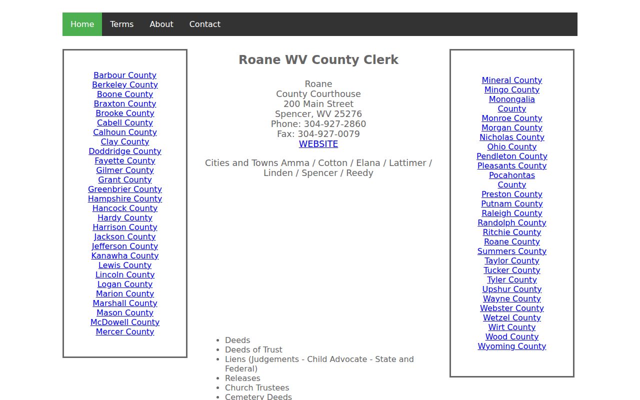
Use the categories to frame a request. Then confirm search and copy options with the Clerk, since exact online coverage and fees stay with that office.
Roane County Assessment Search Fields
The statewide assessment search offers several ways into a parcel. Visible fields include county, district, full parcel ID, owner name, map number, property class, street name, parcel, tax class, sub-parcel, and land use. The page does not reveal exact matching behavior or dropdown choices. Begin with one known value. Add filters only when the result set runs broad.
| Search field | Use in Roane County | Record to keep |
|---|---|---|
| Street Name | Find parcels along a known road | Full displayed parcel ID |
| Owner Name | Find holdings under a person or entity | Exact owner string |
| District and parcel | Narrow a rural or map-based lookup | District, map, parcel, suffix |
| Legal description | Link assessment to recorded land text | Text and lot references |
| GIS parcel ID | Connect the roll to map geometry | GIS ID as displayed |
Optional controls can display the legal description and GIS parcel ID. The Appraisal/Sales and Prior Ownership modes are listed as well. Their exact output appears only in results. The WV Property Assessment Search is the public entry point; treat the parcel card as an index into other records, not a substitute for them.
Roane County Assessment Dates and Value
West Virginia fixes ownership, use, and value as of July 1 for the next calendar tax year. A deed recorded after that date can therefore be newer than the owner name shown on the next assessment roll. The state says its property viewer is refreshed annually. A simple transfer may wait for that cycle, while a boundary split can take longer because the county must submit updated tax-map geometry.
West Virginia generally assesses property at 60 percent of fair market value. That ratio explains why an assessed figure is not a sale quote. The Assessor determines ordinary real-estate value; the Tax Commissioner handles natural-resource and industrial real property, while the Board of Public Works assesses public-service operating property. Exemptions, classification, and levy details affect the bill and belong with tax records.
The state’s ad valorem property-tax explanation describes the 60 percent rule. Its annual tax page covers classification and protests. Do not infer a parcel’s market price from the assessment alone.

State rules set the framework for Roane assessments, but each parcel's own traits and sale history still govern the final value.
Roane Parcel Numbers Across State Systems
A Roane parcel number is assembled from several parts. County, district, map, prefix, suffix, and a special identifier can all play a role. The state parcel viewer may drop the special-ID portion. The CAMA assessment system may leave off the county code instead. A number copied from one screen can look shorter. The same number may appear longer on a tax notice or deed. Keep the original formatting intact. Compare the district and map components when something seems off. Lean on the full legal description if a digit or suffix stays unclear. Roane's county code is 54. Copy the official identifier rather than building one from that fact. A map ID only locates a tax parcel. It is not the deed's legal description. When the assessor card and the viewer seem to describe separate parcels, one may be a parent tract. The other may be a later split. The instrument date and recording reference can help here. The deed may have been recorded before updated geometry reached the annual roll.
Checking a Roane Transfer Against the Tax Roll
Ownership, use, and value are fixed each July 1. Everything on the assessment flows from that snapshot. A deed recorded afterward can still be newer than the owner name displayed for the tax year. Simple transfers wait for the annual refresh. Map changes for land transferred during the July-to-June cycle are due by February 1, and a complex division may take longer still. When sources disagree, that timing explains the gap. It never means the recorded deed should be disregarded.
For a transaction or inheritance review, keep the newest deed reference, the parcel card, the tax year, and the map view together. Each county office answers a different question. The County Clerk handles an instrument, an index entry, or a copy request. The Assessor can say whether an ownership or map update has reached the roll, and county collections takes a ticket or balance question. Keeping those roles straight keeps an assessment screen from being mistaken for a title record or a payment ledger.
Roane County Property Record Types
A complete Roane County property record search often needs more than one file. A deed shows a conveyance. An assessment card describes the parcel for tax administration. A court case can explain a dispute. A map offers a visual reference. The keeper and access route change with each record type.
| Record Type | What It Documents | Kept By | Access |
|---|---|---|---|
| Deeds and related instruments | Transfers, security, liens, releases, plats | Roane County Clerk | WV Land Records categories; ask about index and copies |
| Assessment roll | Owner string, parcel, classification, value | Roane Assessor and WV Tax Division | State search and courthouse office |
| Tax tickets | Bill year, levy, payment or delinquency status | Roane Sheriff / County Collections | Ask the county; State Auditor portal for delinquent land |
| Parcel maps | Surface parcel shape, ID, address context | Roane GIS and WV Property Viewer | Free online viewers and GIS Clearinghouse files |
| Court and probate files | Foreclosure, title disputes, estate proceedings | Roane Circuit Clerk and court offices | Judiciary access links, then validate with the clerk |
For a transfer, look to the County Clerk. For a tax value or assessment year, start with the Assessor. For unpaid land or a delinquent sale path, check collections and the State Auditor. A lawsuit can add context, though a docket entry is not the land instrument. The parcel viewer helps locate geometry, while a deed or survey controls legal boundary work. The Roane County deed-record index covers ownership moves. The property tax records answer the value side of the same parcel question.
Roane Parcel Maps and Their Limits
The WV Property Viewer displays surface parcels. It can open a selected card with the property owner, physical address, description, building information, cost values, appraised values, community, E-911 address, delinquent status, flood information, and external map links. Copy Link and Download KMZ are among its controls. A Roane County ArcGIS viewer also exists, but its dynamic interface limits automated reading. Use a map to orient a parcel. Compare surrounding shapes, and carry a GIS ID into another search. Do not treat the line as a legal boundary. West Virginia's FAQ says tax-map lines are not conclusive evidence in court. Calculated acreage is only an estimate. Deeded acreage takes precedence for tax assessment when the two differ. When the exact line or acreage affects a sale, easement, or dispute, a licensed survey and the deed description are what matter. The WV Property Viewer includes parcel, address, and flood layers. It is the statewide viewer used for Roane parcels.
The state FAQ answers this directly. It points to the GIS Clearinghouse, which provides downloadable surface tax-map data at no charge under SB 588.
Roane County Land Books and Courthouse Loss
Roane County was formed in 1856 from Kanawha, Jackson, and Gilmer counties. Any search reaching before that date may need to move into parent-county records. The statutory table at West Virginia Code §37-10-1 lists Roane land books. It covers 1856 through 1861. That range covers land books only, not online deed-index coverage. Three courthouses have stood on the Spencer site, built in 1856, 1887, and 1965. The first two burned and records were destroyed, per the state court history. If a chain shows a gap, document what was checked. Ask the County Clerk about surviving volumes. Then cross-check parent-county books, state archives, tax books, probate, newspapers, and later corrective deeds. The historic land-book table is a useful date anchor. It is not a deed-image coverage claim.
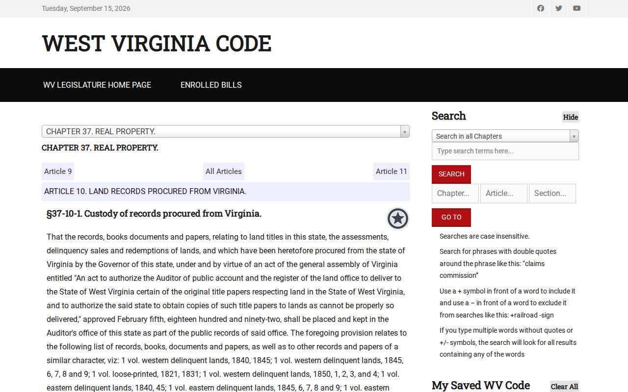
That record distinction helps explain why a local online search may not tell the full history of older Roane County land.
Roane County Tax Dates and Delinquent Land
West Virginia tax tickets come out on or after July 15. The first installment falls due September 1, the second on March 1. Pay early and you earn a 2.5 percent discount. Delinquent interest runs 9 percent a year. The first half turns delinquent October 1, the second April 1. This calendar helps you tell things apart. You can spot an unpaid Roane County tax bill before it becomes a recorded transfer or a finished tax deed.
For delinquent land, start with the State Auditor's County Collections entry point. Its Delinquent Lands layer is the next stop. That layer is updated weekly. Still, a listing is not a completed tax deed. Check notices, redemption rights, later conveyances, and any court challenge under current Chapter 11A before you conclude anything about a Roane County parcel. The statewide property-tax due-date schedule explains the calendar. Roane County publishes no county-specific online ticket URL. Ask the Sheriff or County Collections office about a bill.

The timing table puts a tax status in context. It cannot show whether a specific Roane County bill has been paid.
Spencer, Reedy, and County Record Geography
Spencer and Reedy are Roane County's only incorporated municipalities. Spencer is the county seat. Reedy is a small northern town. Walton, Left Hand, and similar named places are communities, not separate recorder jurisdictions. A Spencer or Reedy postal label therefore never creates its own city assessor or deed office. Roane County land records stay in county hands.
For a city action, contact the municipal office directly. Spencer's official services page covers planning and development, public works, streets, utilities, and unsafe-structure work. However, the town posts no searchable permit database. Reedy's state directory lists a municipal contact but no permit or zoning portal. Ask each town about a specific address and record type. Lean on the county and state systems for ownership, deeds, taxes, and parcel data.
Requesting Roane County Records Offline
A portal may leave out a book, image, or result. Send a specific request to the office holding the record. West Virginia FOIA, W. Va. Code §29B-1-3, requires a public-record request to describe the material with reasonable specificity. The public body must respond as soon as practicable. That deadline is no later than five days, excluding weekends and legal holidays. Its options are limited. It can provide the record, set an inspection time, or send a written denial with reasons.
A public body may charge actual reproduction costs. It may not bill for search, retrieval, or hourly research as part of reproduction. Name the county and the parties. Add the likely date range and the instrument category. Include any book/page or parcel number you have. Ask separately about certification and the Clerk's current copy schedule. Roane County deed fees are not posted online. The West Virginia FOIA text states the request rule. The Clerk's own page is the right place to confirm this. It shows which land-record category and courthouse book to request.
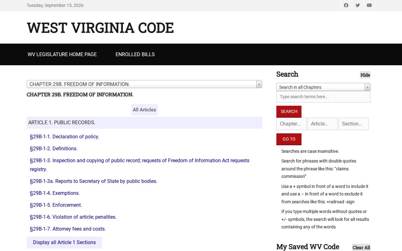
Use a focused request when an online index comes up silent. Let the custodian name any exemption or alternate access route.
Roane Owner Names Held by Businesses
A Roane County parcel can sit in the name of a limited liability company, trust, or estate. Another organization can hold the land as well. Search the assessor's owner field exactly as it appears. Then match the grantee on the deed. A company name calls for one more source. The West Virginia Secretary of State's organization search can surface public filing, agent, or officer information. It will not reveal every beneficial owner. Nor does it prove the company still owns the land.
Use the standard organization search for a name or agent. The advanced form adds street, city, county, state, organization type, and record ID fields. A percent sign works as a documented wildcard. Once you find a filing, return to the County Clerk deed and the assessor parcel. That keeps the entity record from being mistaken for a land record. That cross-check aids deed research. It is no substitute for the grantor-grantee trail or legal advice about title.
What Roane County Property Records Cannot Prove
Public deed, assessment, tax, and map records can support a careful property review. But each has a limit. An owner-of-record field can lag a recent transfer. The state viewer is refreshed only annually. A map line is not a survey. A tax bill identifies an account and its payment status, not clear title. A delinquent-land entry does not prove a tax deed was completed. When the question turns on legal rights, read the underlying instrument and any court order.
Lawful use. Roane County records support ownership research, property due diligence, tax review, and civic transparency. Do not use personal information to stalk, threaten, harass, or harm anyone. A search is not a title opinion, survey, or appraisal.